
Quiet, suburban Rosedale is clustered along the Queens-Nassau County border, between Laurelton in the west and Valley Stream and Woodmere in the east. When visiting the area a couple of years ago, I was struck not by its architecture, which is mostly 1950s and 60s suburban sprawl; I was more impressed with its resemblance to neighboring Nassau. It seems to be a part of Queens only by political considerations.
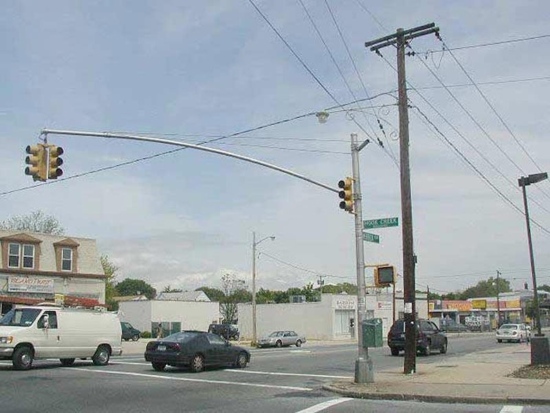
Until 1898, when New York City expanded to five boroughs, Queens and Nassau were one (very) large county. As you move along the Queens-Nassau border, shown above at Hook Creek and Merrick Boulevards, you can see places where they might as well have never separated.
It’s also a place where some of Long Island’s longest roads begin and end.

A 1910 map by Hammond shows Rosedale as it was around 1910, when southern Queens was mostly farmland dotted with small towns. The Long Island Rail Road was already well-established by then; the Springfield station was eliminated in 1939 when grade crossings in this part of town were. The area is presently served by the Laurelton station, with the town of Springfield absorbed by the new Laurelton Land Company real-estate development in the early-20th century. In the map, the pink is the town of Hempstead, Nassau County; the yellow is Queens.
The red line represents the aqueduct, or conduit, carrying water between the now-demolished Brooklyn Water Works near Freeport back to the city. The ruins of the works can still be seen as you ride the LIRR directly past. The aqueduct has lent its name to Aqueduct Race Track as well as North and South Conduit Aves.
As you can see from the map, many of the area’s main roads are already there in 1910; some date back to the colonial era. Freeman’s Path, later Farmers Ave., was renamed for the area’s agriculture and amazingly, is still so-called, even though all of Queens’ farms are gone, except for the Queens Farm Museum in Little Neck. It was renamed Farmers Blvd. (known to hip-hop fans by the LL Cool J tribute) after a county edict in the early-20th century mandated that many of Queens’ main roads be renamed “boulevard”: hence, Vernon Blvd., Northern Blvd., Springfield Blvd., etc.

While Brookville Park encompasses 90 acres, most of it, the portion south of 149th Ave., is undeveloped and wild. The cultivated section is generally between South Conduit Ave., 147th Ave., 232nd St. and Brookville Blvd. A natural stream divides that section in two, punctuated by Conselyea’s Pond just north of 147th.

A long-forgotten spur of the Long Island Rail Road, known as the Cedarhurst Cutoff, once ran southeast through Rosedale. Today it’s remembered only by the street pattern (a glance at the map shows Edgewood and Huxley Streets diagonally cutting through the grid for no discernible purpose; the RR once ran between the two streets). And, there’s a lengthy clearing in Brookville Park corresponding to the RR’s old route.
As Bob Andersen explains at lirrhistory.com, the line connecting the main line to Cedarhurst was only in active use between 1872, when it was built, and about 1880. Yet the LIRR had high hopes for it and it was rebuilt in both 1918 and 1928, the latter an electrification, but trains never ran on the route again and by World War II, the rails had been torn up.

Francis Lewis Blvd. (Cross Island Blvd.) at Crocheron Ave. in Auburndale in 1938. It was easy driving then! “Frankie Lew” has become an eight-lane behemoth since. Francis Lewis Blvd., named for a Queens resident (1713-1803) who was a signer of the Declaration of Independence, is the longest street that’s restricted to Queens (there are longer roads like Northern Blvd. that are longer, but extend far into Nassau and Suffolk Counties). It runs through Whitestone, Auburndale, Fresh Meadows, Holliswood, Hollis, Cambria Heights, and Rosedale.
Lewis, a Welshman by birth, arrived in New York in 1734 and moved to Long Island in 1775; he became a delegate to the Second Continental Congress from New York. Shortly after he signed the document, the British destroyed his home and property and took his wife prisoner for several months; she died shortly after her release. Lewis lived in poverty for the rest of his life.
The boulevard is a relatively recent arrival. It doesn’t appear on maps until the 1920s, was initially called Cross Island Blvd., and initially extended only as far as Springfield Blvd. Probably to avoid confusion, it was renamed for the Queens patriot at about the same time as Robert Moses’ new Cross Island Parkway, the eastern end of the Belt Parkway system, opened in 1940.

Hungry Harbor Rd. extends from Hook Creek Blvd., crossing the boulevard’s titular creek before entering the town of Woodmere and changing its name to Rosedale Rd. The origins of this name are a mystery. However, a publication honoring the 50th anniversary of Valley Stream, published decades ago, has this to say:
“On the extreme southwest, approaching Jamaica Bay, was Hungry Harbor, so called because it was largely a settlement of squatters, and the squatters went hungry a goodly part of the time. True, it was a harbor because it was the only area of farmland that possessed rich fertile land in addition to having access to the sea.”

Cosmo Kramer, finding himself at 1st Ave. and 1st St. (a corner that actually exists, in the East Village), called it “the nexus of the universe.” Rosedale, then, must be the edge of the universe… it has NYC’s highest-numbered streets, when you add the cross streets together. NYC’s highest-numbered individual street, 271st, is in Bellerose. But the biggest sums are in Rosedale, such as the 401 shown here. The biggest sum of all in Rosedale is 411, at 149th Ave. and 262nd St.

Sunrise Highway was begun in 1926 and was never really finished. It’s an at-grade highway in some sections, and an elevated expressway in others. The expressway sections in Nassau and Suffolk Counties were begun in 1958 and the latest, in Oakdale in Suffolk, was finished in 1998. The highway proper is State Highway 27 (as Linden Blvd. is in Brooklyn and Queens) and carries the name Sunrise Highway as far as County Road 39 in Shinnecock Hills.
The road is a cognate of sorts of Los Angeles’ Sunset Blvd., albeit much less glamorous. The highway extends west into Queens, or rather proceeds from Queens east, for the better part of a mile, as an eastern outgrowth of the Belt Parkway.
—Kevin Walsh is the webmaster of the award-winning website Forgotten NY, and the author of the books Forgotten New York (HarperCollins, 2006) and also, with the Greater Astoria Historical Society, Forgotten Queens (Arcadia, 2013)