
Staten Island has a number of curious neighborhood names, in contrast to Manhattan which is fairly bland, with its Financial Districts, Upper East and West Sides, Midtowns and acronyms like Tribeca, Soho and Noho. As with most of the rest of New York, European settlement on Staten Island began with the Dutch when abortive settlements on the island were made in the 1640s and 1650s. Those were scuttled during the Dutch-Indian wars raging under governors Willem Kieft and Peter Stuyvesant. Permanent settlement in Staten Eylandt (or “State Island,” for the Dutch governing body) began in the 1660s in the area now occupied by Fort Wadsworth and South Beach. When the county system in New York was established by the British in 1683 the name Richmond was chosen, which derives from the title of Charles Lennox, 1st Duke of Richmond, an illegitimate son of King Charles II. Many of Staten Island’s major roads bear the name Richmond; even Victory Blvd. was laid out as Richmond Turnpike by Vice President Daniel Tompkins in 1818. In 1975, the name of the borough was switched to Staten Island, with the county name remaining Richmond.
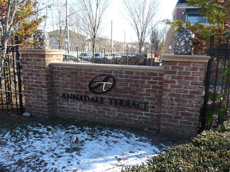
Annadale, which takes its charming name from Anna Seguine, a member of a prominent local family in the 19th century, is a pleasant suburban community in mid-Staten Island that grew up along Staten Island Rapid Transit, now called the Staten Island Railway. Well into the 20th century, Annadale had few telephones, no dentists, a single general practitioner, and no public school; children attended schools in the next town, Huguenot. However, milk, bread and ice were delivered directly to area homes. As with other rural Staten Island communities, the opening of the Verrazano-Narrows Bridge changed everything, and soon streets and subdivisions were laid out. You can glimpse a bit of the old days at the neighborhoods’ train stations, which retains some of the town center atmosphere they used to have when regular conductors knew the names of everyone who took the train.

Arrochar, the first part of Staten Island that the S-53 bus visits when it comes off the Verrazzano Bridge from Brooklyn, is often the starting point for my Staten Island peregrinations. Arrochar (pronounced ARROW-car) on Staten Island’s easternmost extension, encompasses Fort Wadsworth, now a Gateway Recreation Area as well as the northern section of South Beach and its lengthy boardwalk. The area was settled by Scottish immigrant W. W. MacFarland in the 1840s; he named his estate, Arrochar, after the small village NW of Glasgow he hailed from. MacFarland’s home still stands on the St. Joseph Hill Academy campus, and there’s an avenue named for him.

Bulls’ Head, a small area of Staten Island bordered by the Staten Island Expressway, Richmond Ave., Victory Blvd. and the wetlands area/Teleport, is named for a vanished Revolutionary War-era tavern that had a large sign featuring the titular bovine (perhaps an inspiration for Signs Rd., one of the drags through the region). The tavern was a meeting place for British troops and other Tory residents of the area. The same idea went into naming Fingerboard Rd. on the eastern end of the island, which according to legend was named for a large sign in the shape of a pointing finder (like the Clam Broth sign in Hoboken) that pointed travelers to the county seat, then located mid-island in Richmondtown.

Concord is a Staten Island neighborhood neatly self-contained by West Fingerboard Rd., Richmond Rd., Staten Island Railway, and since 1964, the Staten Island Expressway. As the sign says, Concord was “established” here in 1845, but there was human habitation here before that: the region had been called Dutch Farms, but it was renamed for the Massachusetts town after several famed writers lived there, such as Henry David Thoreau and Judge William Emerson, from whom nearby Emerson Hill gets its name, the brother of Transcendentalist-philosophy writer Ralph Waldo Emerson. Thoreau tutored Judge Emerson’s children here in the spring and summer of 1843, the only time in his adult life Thoreau lived outside Concord, MA.
Concord High School, now PS 14, is a fine brick structure going back to the early-20th century.

Dongan Hills is a neighborhood just north of Grant City. and south of Old Town along Richmond Rd., which skirts the mid-island hills. Irish Catholic Thomas Dongan (1634-1715) was appointed governor of New York by the Duke of York in 1682 and remained at that post until 1689. His tenure was marked by religious toleration, rare in that era; his family had to move to France when he was a boy when Oliver Cromwell’s forces overthrew and executed Charles I in 1649, and perhaps Dongan was sensitive to the persecution of faiths other than the Church of England. Dongan convened the first representative assembly in New York history. He became 2nd Earl of Limerick in 1698. As part of his appointment he was granted 5100 acres in what is now Dongan Hills, which he later expanded to 25,000 acres. His legacy is remembered here, along with three streets on the island named for him.
The Perine House, on Richmond Road, built in the late-17th century, is among Staten Island and New York State’s oldest residences.

Staten Islanders don’t bat an eye about their waterway names, such as Kill Van Kull and Arthur Kill, or the neighborhood of Great Kills, another in the string of communities along the southeastern shore that include Bay Terrace, New Dorp, Eltingville and Charleston. Here, the word “kill” has nothing to do with murder, or even hunting. It goes back to the Dutch days and was a general term for narrow waterway. Hence, Arthur Kill was originally achter kil, or “back waterway.” Great Kills referred to small streams or rivulets; “great” may refer to their size, or perhaps quality, if the fishing was good. Jack’s Pond, shown above, is fed by one of these streams, most of which have been diverted underground.

A Swiss political leader, the burgomaster, or mayor, of Geneva, Bezanson Hugues (1491–1532) ultimately gave his name to this neighborhood on Staten Island’s southeast shore between Arden Heights and Charleston. After Martin Luther founded Protestantism in Germany with his 95 Theses in 1517, the movement spread throughout Europe and ultimately worldwide, France was no exception, though French royalty fought fiercely against it, instigating the French Wars of religion in the late-1500s and continued severe repression of members of the French Reformed Church, or the Huguenots, as they came to be called after Hugues provided some key leadership, led some to immigrate to the new world including Staten Island. French Protestants wouldn’t gain equal rights as citizens until 1789. The Reformed Church of Hugenot Park on Amboy Rd., shown here, goes back to the mid-19th century when this region was sparsely settled.

Staten Island, by far New York City’s mountainous borough, supports a few inland lighthouses. The most spectacular is located on this 220-foot hill that looms above Egbertville Ravine, carved through by the meandering Richmond Creek. It’s an area of great wealth, but in some ways, it’s still emerging from its original rurality; you expect to see a country general store or little red schoolhouse. There’s the occasional corral for horses. Richmond Creek is bridged occasionally, almost casually, by bridges over the roads, which are occasionally interrupted for no special reason. In this casual setting, though, are some architectural marvels crucial to New York City’s status as a place where if you turn a corner anything can happen.
Officially known as the Ambrose Channel Range Light, the Staten Island Lighthouse was built here in 1912 and the Coast Guard still employs its light. It’s the largest of the borough’s lighthouses. Even though it’s far inland, its light can be seen far out to sea, as much as 18 miles out.
The 90-foot-tall octagonal structure, made with light brown bricks, can be seen from the bottom of the hill at Lighthouse Ave. and Richmond Rd., looming like a benevolent protector. To get closer to the lighthouse, climb steep Lighthouse Ave., follow it all the way to Terrace Court and then double back on Edinboro Rd. It can be seen from Manor Court and from Lighthouse Ave.’s length as well.
—Kevin Walsh is the webmaster of the award-winning website Forgotten NY, and the author of the books Forgotten New York (HarperCollins, 2006) and also, with the Greater Astoria Historical Society, Forgotten Queens (Arcadia, 2013)