
It’s not what you think, this isn’t really “nude” Utrecht, and I didn’t stumble on a Spencer Tunick tableau when out adventuring. I was on my way to Church Ave. in Kensington when I indulged a fascination of mine for many years: the three blocks of New Utrecht Ave. in Borough Park that are uncovered by an elevated train. When riding the buses all over southern Brooklyn as a kid, I was on the B35 one day rolling up 39th St. and passed an elevated train over 10th Ave. instead of where it “should” have been, according to all the maps in my collection, on New Utrecht Ave.
New Utrecht Ave. runs southeast from about the intersection of 9th Ave. and 39th St. a few miles to 86th St. just past its intersection with 18th Ave. For most of its length the West End elevated line shadows it. For many years, B and M trains plied the line, but several years ago when repairs to the Manhattan Bridge were completed and trains again ran on both sides of it, the alphabet soup of Brooklyn subway lines was re-stirred and the B was assigned to the Brighton line, buddying up with the Q, while the D wound up on the West End. By 2010, the M was running between two termini in Queens, Continental Ave. in Forest Hills and Metropolitan Avenue in Middle Village.
New Utrecht (pronounced, in Brooklyn, at least, “YOU-trekt”) Ave. was so named because it went to the Town of New Utrecht, founded in the 1600s and one of the six towns that existed in Kings County before all were consolidated into the City of Brooklyn in 1896 and then into New York City in 1898. The town of New Utrecht was named for Utrecht, Netherlands, the fourth largest city in that country. In Dutch, “Utrecht” is derived from two words that mean “old fort,” so that “New Utrecht” means “New Old Fort.”
I was surprised to learn that New Utrecht Ave. existed long before the railroad that ran along it and the elevated train that replaced it ever existed. The road was laid out in the 1830s after some protracted negotiations with Dutch landowners, descendants of original settlers, and attained its full length in the 1850s. It was known in its early years as the Brooklyn, Greenwood and Bath Plank Rd., as it originally had a wood roadbed and stretched from the southern edge of the City of Brooklyn at Green-Wood Cemetery and ran to Bath Beach, named for the British spa town on the Avon, famous in high-school British lit classes for the Wife of Bath, the randy, frequently-married heroine featured in Chaucer’s 14th-century Canterbury Tales. This was a recreational area in Brooklyn too, as villas and yacht clubs clustered near the shore, until the Depression ended its run.
The railroad becomes part of the New Utrecht Ave. story in 1863, when a steam railroad built by Charles Godfrey Gunther, a former NYC mayor, was built from the entrance to Green-Wood Cemetery to Bath Beach. The line necessitated a transfer at 36th St. (just as today’s subways do from the D to the N and R) because steam railroads were forbidden in Brooklyn. A horsecar line completed the run from 5th and 36th to 5th and 25th. The steam line was completed out to Coney Island in 1864, where it met the West End Hotel. After an 1885 reorganization the line became the Brooklyn, Bath and West End Railroad, was electrified by overhead catenary wire in 1893, was acquired by Brooklyn Rapid Transit in 1898, and finally, was replaced by the West End Elevated in November 1916. Unfortunately, Godfrey’s name never attached itself to subsequent iterations of his railroad the way Andrew Culver’s did to what is now the F train in Brooklyn.

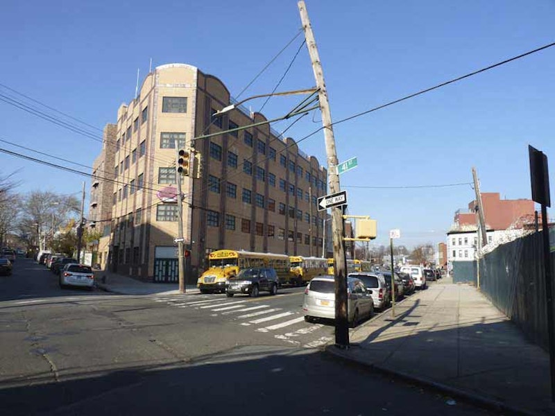
When I was riding in that B35 bus all those years ago, I was mystified that the el was on 10th Ave., not New Utrecht Ave. My amazement is rooted on this Hagstrom map, here in a 1948 edition, but rendered like this until the hand-drawn map was discontinued in 1998 and succeeded by a computer-generated edition—it shows the West End El proceeding up New Utrecht Ave. to 9th Ave., when in reality, it turns onto 10th Ave. at 41st St., runs there for two blocks, and turns onto a right-of way north of 39th St.
All of the hand-drawn street maps in common release for many years that indicated transit lines—Hagstrom, Geographia, and Colorprint (distributed by American Maps) perpetuated this error and continue to do so—Geographia, which still distributes hand-drawn editions, and Hagstrom, which started using computer-generated maps for NYC in 1998. It’s a small point, but these companies otherwise strive for accuracy.

One exception was the Belcher-Hyde maps, which showed tremendous detail not possible on other maps of smaller scale. In 1929 Belcher-Hyde produced what they called a “Brooklyn Desk Atlas.” For many years my experience with it was limited to a crumbling copy in the archives of the Brooklyn Business Library; several years later, Brian Merlis of brooklynpix showed me a pristine copy in his personal collection. However, Historic Map Works has had it online for a few years now. The desk atlas was likely high-priced for the time and didn’t compete with the mass-market maps produced by Rand McNally and other map makers in the 1920s.
On the atlas, elevated lines are shown by thin straight lines, interrupted to show street names, interspersed with dots. Here, the West End Line is correctly depicted as diverging from New Utrecht Ave. at 10th Ave., following it for two blocks, then turning left.

Google Maps, correct about 95 percent of the time, gets the configuration right here, with the D train following its actual course. Why has this error been perpetrated all these years? I have no idea. Hagstrom first produced NYC street maps in 1916, but I don’t know if the earliest editions featured transit lines. That was the year that the surface line along the avenue ended and the el began service, so showing it running straight down New Utrecht Ave. may be a carryover from earlier maps showing that instead of the 10th Ave. detour. The answer may be that it was easier to draw the lines that way, but that hasn’t stopped otherwise accurate depictions on other transit lines.

The first building located on New Utrecht Ave. is the 9th Ave. stationhouse serving D trains, the easternmost end of a large transit complex combining subway yards and a bus depot. Just east of the station, the West End swiftly rises to an elevated structure, where it remains all the way to Coney Island.
Looking at the west end of the 9th Ave. platform. Because of shadows, it’s hard to see, but there’s a set of tracks on the left that run into a now-shuttered lower level of the 9th Ave. station. It had a center platform, tiled walls that resembled other BMT stations, large enamel navy blue and white plaques with the station name, “9th Avenue” hanging from the ceiling, and white and black enamel signs with the number 9 on supporting pillars. The lower level served Culver Line bound trains from 1919 to 1954, and Culver shuttle trains from 1954 to 1975, after which the lower level was no longer used for passenger service. NYC Subway has a few dozen photos of the lower level.
However, the lower level wasn’t quite finished after that, because in the final scene of the 1987 movie Crocodile Dundee it stands in for the IND 59th Street-Columbus Circle station in which Croc “walks” on the shoulders of a platform crowd to rejoin his girlfriend.

9th Ave. reaches its eastern end at 37th St. and Green-Wood Cemetery. When I was a kid, I thought of 9th Ave. as a mysterious entity, since it did NOT extend into Bay Ridge. Because of a changing angle of street grid orientation, 10th Ave. follows 7th as you travel southeast on 86th St., while 8th Ave. begins at 73rd and 9th Ave. at Bay Ridge Parkway, where its eastern path was interrupted as frequently as I perceived that the cartoons were by breaking news reports. 9th Ave. was stopped cold by Leif Ericson Square, and then by the open cut of the N train. Its only continuous stretch runs from the cemetery and 37th St. to 61st St., where it meets the open cut.
In the 1970s, I discovered that the very fence, where the arrow sign is located now, had a diamond-shaped sign saying, “DEAD END.” In front of a cemetery, no less. Never mind that it wasn’t really a dead end and motorists could proceed in either direction. Eventually the sign was removed.

Two blocks off New Utrecht Ave. proceed south from 9th Ave. If hipsters invade the Sunset-Borough Parks border and want to open a barber/haberdasher shop, or artisanal chocolates with recipes purloined from other companies, or organ meat restaurants with stuffed animal heads on the walls on New Utrecht Ave., they can go ahead and call it “Nude Utrecht.” Fine by me.

While patrolling the area in 2010, I got one of my favorite photos ever, an abandoned beauty salon at 40th St. and 10th Ave. below the West End el. It had its old glass-stencil signage and wilted plants in the window. It was converted into a deli soon after, and is once again untenanted in 2024.
—Kevin Walsh is the webmaster of the award-winning website Forgotten NY, and the author of the books Forgotten New York (HarperCollins, 2006) and also, with the Greater Astoria Historical Society, Forgotten Queens (Arcadia, 2013)